From project to project, the answers are unlikely to be the same. Why? Because there is no one-size-fits-all approach to ‘good practice’. Because exciting new technologies can motivate project success, but also lead to project failure if they are not accompanied by processes that also motivate social, political and economic change. Because project windows are finite and project implementers need to define their own risk ‘comfort-levels’. Because information availability at the time of project design is never 100%, and we need ways to assess ‘what the absence of information means to investment design’.
These reasons are just some of the drivers behind developing the MCC Land Records and Transaction Systems Technology Toolkit (or LRTS Toolkit), which Kate Fairlie introduced at an event LEI co-hosted with ESRI and the Millennium Challenge Corporation. Essentially, we wanted to design a tool that would make it easier to design and cost projects, easier to assess what is needed, and easier to ensure that projects would succeed and be sustainable, even in the context of a five-year investment window.
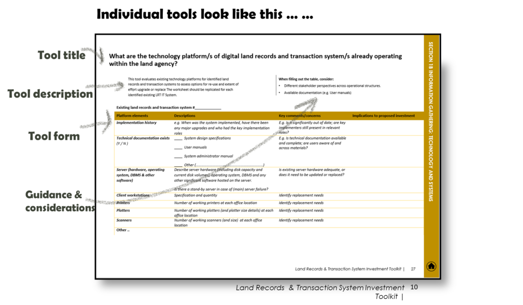
Tool co-author Kate Fairlie stepped through a quick overview of the tool, including the following description:
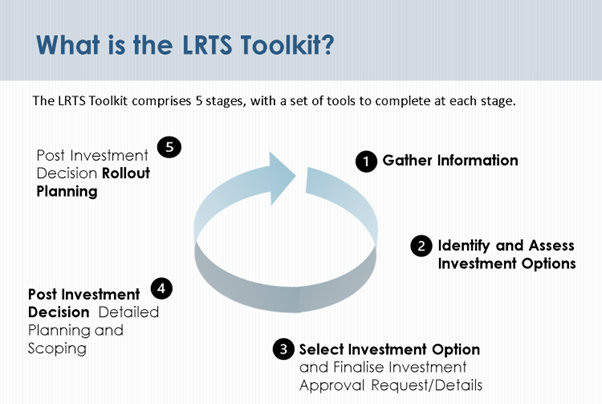
The LRTS Toolkit contains 5 stages, each comprising a set of tools – you can think of them like worksheets or prompts – of key data or questions to be considered.
Stages 1, 2 and 3 are the preliminary stages undertaken prior to any solid investment decision being made. They assist in gathering information, providing a baseline dataset against which monitoring and evaluation targets can be measured, identifying core issues, and ultimately identifying and narrowing down three investment options and assessing the sustainability and risk features of these. The three investment options are suggested to include low (or no), medium and high technology implementations – recognising that the scale of technology reform is indicative of project size and cost.
After an investment option is selected, Stages 4 and 5 provide a guide for what additional details might be needed to support a sustainable investment. These include procurement activities, detailed budgeting up to a 10 year time horizon, and roll out activities.
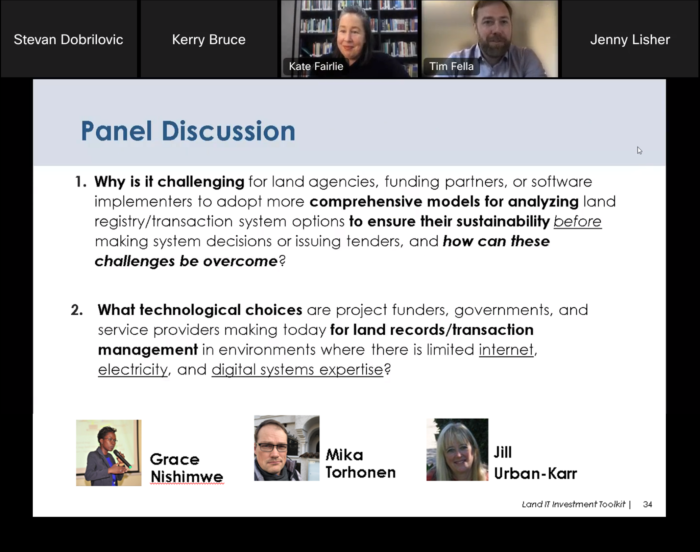
After presenting the tool, three well known panellists – Grace Nishimwe, Jill Urban-Karr and Mika Torhonen – together with ESRI’s Tim Fella provided a robust discussion, covering why designing sustainable projects was so hard, as well as technology choices for difficult environments.
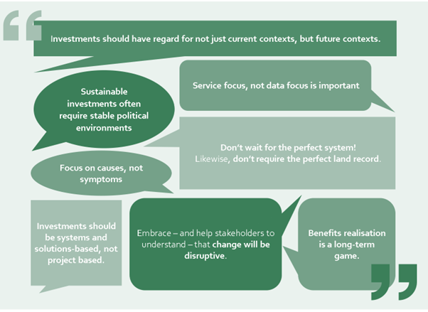
It’s always difficult – if not impossible – to sufficiently reduce such rich conversations into key insights and take-aways. Nonetheless, we’ve made the attempt with the following points we found valuable:
- Sustainable investments often require stable political environments
- Investments should have regard for not just current contexts, but future contexts.
- Focus on causes, not symptoms – and address the long-term, not the short-term. It’s important for land agencies to stop ‘firefighting’ or ‘trouble shooting’ the problems that are continually cropping up, and get to the systemic causes.
- Investments should be systems and solutions-based, not project based.
- Embrace – and help stakeholders to understand – that change will be disruptive.
- Benefits realisation is a long-term game. Past land administration projects that were considered less-successful at the time, have seen outstanding progress in the years since. We must continue to recognise that benefits are unlikely to be realised during project timeframes.
- Service focus, not data focus is important. Who is this service for? What are the policy goals?
- Don’t wait for the perfect system! Likewise, don’t require the perfect land record. Expect to refine data over time.
And the best supporting actor award goes to… ! One of our favourite comments from the webinar was that land systems are not lead actors, but are still essential for many public, social and economic needs.
We encourage you to take a look at the tool and come back to us with any comments, questions or improvements. We also encourage you to take a look at the State of Practice document, which was the precursor and background to this work.
Many thanks to Jill Pike and Steve Dobrilovic from the Millennium Challenge Corporation for their close collaboration throughout development of the Toolkit, and preparation for this webinar. Special thanks to all those who have previously commented on or tested the toolkit in some manner. And congratulations to Tony Burns, Kate Fairlie and Neil Pullar for your exceptional effort in creating this tool!