Improving Resilience of National Land and Geospatial Systems

Project details

Country

Client

Project Timeframe

Key Services

Project Key Information

Investing in the land administration system of Kerala State is necessary to increase the resilience to natural disasters, particularly by improving the access to and reliability of underlying data sets for emergency response and risk planning. To improve Kerala’s future resilience, LEI provided a rapid review of the functions of registration, service provision, land records, surveying, valuation, institutional arrangements and mandates.

Project Narrative

Until recently, disaster risk management (DRM) investments financed by the World Bank (and the wider international development community) commonly considered national land administration and geospatial information systems as too antiquated, inaccessible, out of date and/or cumbersome to integrate with more technologically-advanced applications – such as weather and climate monitoring, early warning systems, and resilience-focused planning. Yet improvements and enhancements to these systems have a huge potential to improve national disaster resilience and address the needs and risks of on-the-ground emergency response data and services. Improvements can include elements and actions like the integration of data-sets, improved standardisation of data and data formats, ensuring common reference systems in use and improving joint coordination through formalisation of data sharing, exchange and servicing platforms. These efforts allow for much more effective and efficient planning, response, recovery and rebuilding for disasters.

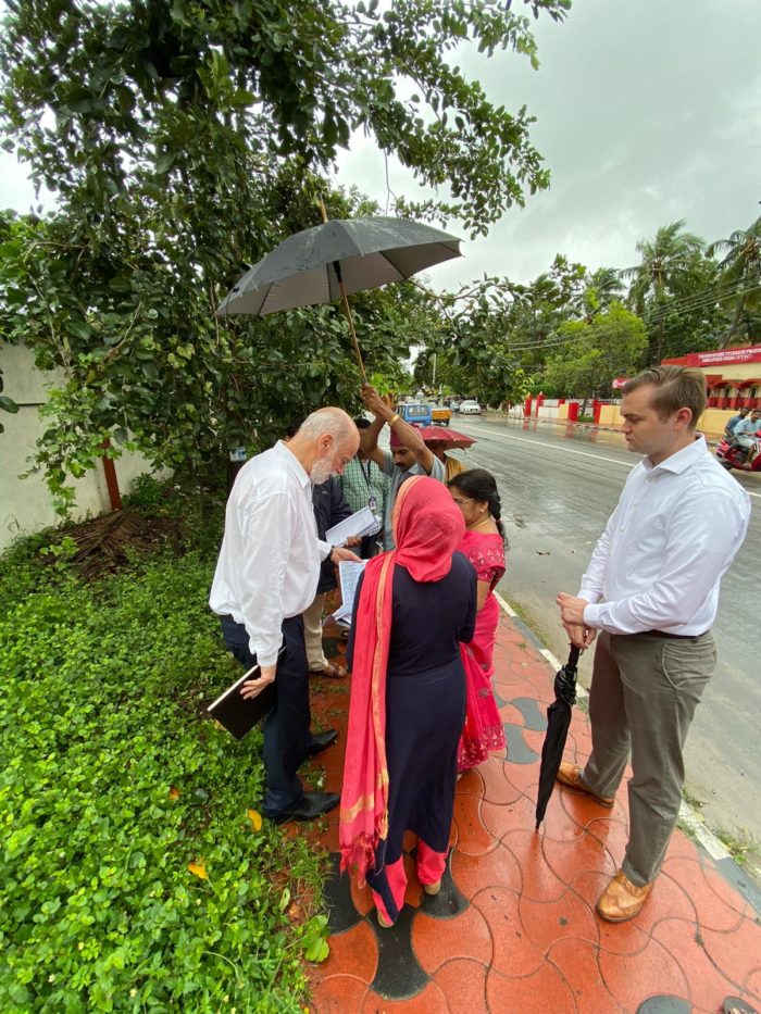
This technical assistance project supported the development of an action plan for Kerala State, India for increasing the resilience and resilience impacts of its national land administration and geospatial information systems. The action plan included the following stages: (i) diagnosis of the current land administration and geospatial information systems and their infrastructure and resilience impact; (ii) definition of disaster risk typology and readiness of these systems to provide for disaster risk management and applications; (iii) strategic roadmap development for programmatic approaches for improving the systems for resilience; (iv) a multi-stakeholder workshop for action plan development; and (v) identification of an investment plan to increase the resilience and resilience impact of Kerala State’s national land administration and geospatial information systems.

Key Services Provided

LEI’s, Executive Director, Tony Burns worked within a team of specialists to assess Kerala State’s land administration system, including registration, services, land records, surveying, valuation, institutional arrangements (mandates), and make recommendations for resilience.

Specific attention was given to:

  • the status of land offices,
  • the land records management system,
  • survey plans and maps,
  • the completeness and performance of the land administration system by comparing performance with technical and operational performance standards,
  • a study on revenue generation and sharing scenarios to inform the development of revenue collection processes,
  • roles of the private sector and regulatory requirements,
  • additional service needs to achieve new levels of efficiency, cost-effectiveness, and equity in the delivery of land services, and
  • potential risks of financial sustainability of the land administration system.

In addition to the above assessment, Tony worked with the Task Team’s Lead Land and Geospatial Strategic Specialist to assess the utilisation and impact of Kerala State’s land administration system for disaster risk management and its level of resilience in the event of a disaster; and supported the development of an Action Plan, including a clear definition of activities, their cost and completion time, indicators and expected impacts.

Related Projects

Global Land Facility Programme

LEI are partnering with lead, Tetra Tech, in the implementation of the Land Facility program, funded by the UK FCDO. The Land Facility (LF) is designed as an offer to partner countries with a UK post, to co-design effective programs of land related reform. It can provide rural, forestry and urban land governance expertise and assistance to support partner governments’ efforts to expand their capacity to plan, manage and implement national land administration policy, legislation and system reforms.

Project Narrative Effective land governance systems are key to economic growth, rural livelihoods, climate change resilience, and women’s rights. Land is a key root cause of conflict, with increasing competition

Vanuatu Land Development, Greater Port Vila Infrastructure, Affordable Housing Vanuatu, Resilient Settlements Development, VARS Project Vanuatu, Land Development Strategy Vanuatu, Housing for Low-Income Earners Vanuatu, Vanuatu Urban Planning, Informal Settlements Upgrading, Flood Mitigation Vanuatu, Vanuatu Land Administration, Greenfield Residential Development, Public-Private Partnerships Vanuatu, Vanuatu Land Policy Advisory, Vanuatu Land Development Legal Services, Community Trusts Vanuatu, Sustainable Urban Growth Vanuatu, Vanuatu Infrastructure Development, Land Subdivision Vanuatu, Vanuatu Government Land Development

Vanuatu Affordable and Resilient Settlements (VARS) Project: Procurement of Land Development Policy, Legal and Marketing Advisory Services

The International Development Agency of the World Bank Group is supporting the Government of Vanuatu (GoV) with the Vanuatu Affordable and Resilient Settlements Project (VARS) in an amount of US$25 million, to achieve a long-term vision to provide potable water, sanitation, roads, drainage, and electricity to low-income households.

Project Narrative The overarching development objectives of VARS are to (i) improve access to and resilience of infrastructure and services in selected new and existing settlements, and (ii) strengthen land

Lesotho 2 Compact, Millennium Challenge Corporation, MCC Lesotho, Lesotho economic growth, Lesotho Land and Gender Activity, Market Driven Irrigation Horticulture, MDIH Project Lesotho, rural income improvement Lesotho, irrigation infrastructure Lesotho, commercial horticulture Lesotho, gender equity Lesotho, Lesotho irrigation systems, rural land registration system, gender reforms Lesotho, smallholder farmers Lesotho, anchor farmer Lesotho, irrigation scheme development, land use planning Lesotho, rural land market Lesotho, landholder rights Lesotho, Community Councils Lesotho, land registration Lesotho, Lesotho resettlement services, commercial farming partnerships Lesotho, Tetra Tech consultancy, Land Equity International, Lesotho agriculture projects, rural livelihoods Lesotho, agricultural production agreements, Lesotho land reforms

Market Driven Irrigation Horticulture (MDIH) Land and Gender Activity

The Lesotho II Compact was an agreement between the US government-funded Millenium Challenge Corporation (MCC) and the Kingdom of Lesotho (GoL). It was a $US300 million programme to address binding constraints to economic growth in Lesotho. The Lesotho II compact consisted of three projects designed to combat constraints to economic growth by either strengthening private sector participation and/or by improving government coordination, capacity and execution.

Project Narrative The Lesotho Land and Gender activity (L&G Activity), supported the Lesotho Millennium Challenge Account-II (MCA-Lesotho II) to meet the objectives of the Market Driven Irrigation Horticulture (MDIH) Project

In spirit of reconciliation, Land Equity International acknowledges the Traditional Custodians of country throughout Australia and their connections to land, sea, and community. We pay respects to their Elders past and present and extend that respect to all Aboriginal and Torres Strait Islander people.