MCA-Indonesia’s third project – Participatory Mapping and Planning Sub-Activity No. 3 (PMaP3) – focuses on eleven districts across four provinces. The project is assisting district governments to implement the following three tasks:
- Acquire geo-spatial data and prepare geographic information system databases of land-use/land cover
- Compile and geo-reference existing and pending licences and permits for land and natural resource use, and
- Enhance district spatial plans through capacity building in spatial planning, enforcement and management of land use information in spatially-enabled databases.
Stakeholder participation, especially engagement with provincial and district Development Planning Agencies, is essential to ensuring task implementation with a view towards inter-agency coordination of spatial and land-use planning (and sustainability). The PMaP3 Information Management System (IMS) has been designed for improved and coordinated spatial and land-use planning at the district and provincial levels. Of particular concern, however, is the question of local government commitment to sustained participation and adequate financing for IMS implementation. Strong ownership and an understanding of a system that will fit local needs are key to a successful IMS implementation.
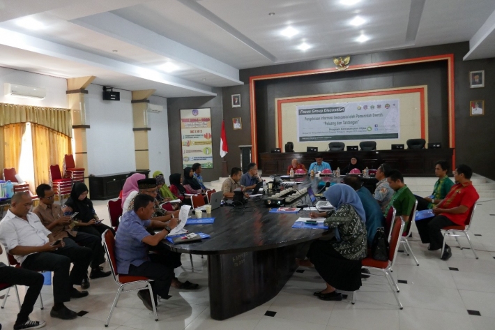
To ensure adequate participation by key decision makers, PMaP3 facilitated the formation of a Geospatial Information Task Force (GITF) in each of the 11 target districts and four provinces. A proposal was presented and discussed during Focus Group Discussions (FGDs) on “Geospatial Information Management by Local Governments: Challenges and Opportunities” – leading to the establishment of fifteen GITFs. These may well be viewed as a critical first step for establishing Local Geospatial Information Network Nodes that will address implementation of the national government-directed One Map Policy at the local government level. Key agency representatives in each district/province attended the FGDs, which were comprised of senior (heads) and technical staff members from local government agencies.
In some districts, GITFs are given legality and budget through a Regent or Governor Decree (Surat Keputusan Bupati/Gubernur). Achieving legality for task forces will demonstrate a high level of local government commitment in ensuring sustainability in relation to managing geospatial data and information at the local level. In addition, most districts and provinces have committed to allocating adequate budgets in support of GITF operations. In South Sulawesi province, for example, PMaP3 is working in three districts (Luwu, North Luwu and South Luwu), and each of the Bappeda (Development Planning Agency) boards have already allocated funds for this year to support the GITFs. All three districts submitted work plans and suggestions for establishing Local Geospatial Information Network Nodes.
GITF member composition and legal support is now final. Each GITF will be comprised of 7-25 individuals from key agencies, and PMaP3 will conduct focused capacity building for each task force. By the end of the project, PMaP3 expects to have at least 100 staff trained and ready to implement the spatially-based IMS in each of the districts and provinces.