One Map Technical Assistance

Project details

Country

Client

Project Timeframe

Key Services

Project Key Information

Support to Indonesia’s One Map Policy through implementation and strengthening of the National Spatial Data Infrastructure for establishing clarity around land use and administrative boundaries at the village level.

Project Narrative

LEI successfully secured the Technical Assistance and Capacity Development for the Program Preparation to Operationalize and Accelerate the One Map Policy (One Map TA project). This project was 12-months in duration and sought to support One Map Policy (OMP) implementation and strengthen the National Spatial Data Infrastructure (NSDI) through the early completion of OMP coverage across all of Indonesia.

Key services provided

The One Map TA project supported the Government of Indonesia to:

  • define procedures and guidelines for OMP implementation
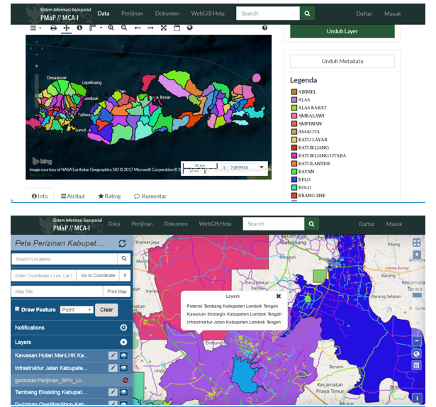
  • enhance access to geospatial data and services
  • compile data on existing concessions and licences
  • verify data on state lands and integrate state land data into the overall land administration system
  • produce fit-for-purpose geospatial data especially in support of improved land management and governance, including the protection of natural resources
  • facilitate participatory community mapping and the incorporation of this mapping into OMP
  • pilot OMP implementation processes, and
  • implement appropriate project management and monitoring for OMP.

Project outputs included:

  1. An analysis of the regulatory system, standards, formats and data sharing policies for the One Map framework and NSDI framework
  2. An analysis of the state/communal/other land designation and registration system
  3. An analysis of participatory village land use mapping methodologies
  4. Preparation of the OMP Operationalisation and Acceleration investment lending operation, and
  5. Capacity building among government agencies to implement the OMP.

Related Projects

Global Land Facility Programme

LEI are partnering with lead, Tetra Tech, in the implementation of the Land Facility program, funded by the UK FCDO. The Land Facility (LF) is designed as an offer to partner countries with a UK post, to co-design effective programs of land related reform. It can provide rural, forestry and urban land governance expertise and assistance to support partner governments’ efforts to expand their capacity to plan, manage and implement national land administration policy, legislation and system reforms.

Project Narrative Effective land governance systems are key to economic growth, rural livelihoods, climate change resilience, and women’s rights. Land is a key root cause of conflict, with increasing competition

Vanuatu Land Development, Greater Port Vila Infrastructure, Affordable Housing Vanuatu, Resilient Settlements Development, VARS Project Vanuatu, Land Development Strategy Vanuatu, Housing for Low-Income Earners Vanuatu, Vanuatu Urban Planning, Informal Settlements Upgrading, Flood Mitigation Vanuatu, Vanuatu Land Administration, Greenfield Residential Development, Public-Private Partnerships Vanuatu, Vanuatu Land Policy Advisory, Vanuatu Land Development Legal Services, Community Trusts Vanuatu, Sustainable Urban Growth Vanuatu, Vanuatu Infrastructure Development, Land Subdivision Vanuatu, Vanuatu Government Land Development

Vanuatu Affordable and Resilient Settlements (VARS) Project: Procurement of Land Development Policy, Legal and Marketing Advisory Services

The International Development Agency of the World Bank Group is supporting the Government of Vanuatu (GoV) with the Vanuatu Affordable and Resilient Settlements Project (VARS) in an amount of US$25 million, to achieve a long-term vision to provide potable water, sanitation, roads, drainage, and electricity to low-income households.

Project Narrative The overarching development objectives of VARS are to (i) improve access to and resilience of infrastructure and services in selected new and existing settlements, and (ii) strengthen land

Lesotho 2 Compact, Millennium Challenge Corporation, MCC Lesotho, Lesotho economic growth, Lesotho Land and Gender Activity, Market Driven Irrigation Horticulture, MDIH Project Lesotho, rural income improvement Lesotho, irrigation infrastructure Lesotho, commercial horticulture Lesotho, gender equity Lesotho, Lesotho irrigation systems, rural land registration system, gender reforms Lesotho, smallholder farmers Lesotho, anchor farmer Lesotho, irrigation scheme development, land use planning Lesotho, rural land market Lesotho, landholder rights Lesotho, Community Councils Lesotho, land registration Lesotho, Lesotho resettlement services, commercial farming partnerships Lesotho, Tetra Tech consultancy, Land Equity International, Lesotho agriculture projects, rural livelihoods Lesotho, agricultural production agreements, Lesotho land reforms

Market Driven Irrigation Horticulture (MDIH) Land and Gender Activity

The Lesotho II Compact was an agreement between the US government-funded Millenium Challenge Corporation (MCC) and the Kingdom of Lesotho (GoL). It was a $US300 million programme to address binding constraints to economic growth in Lesotho. The Lesotho II compact consisted of three projects designed to combat constraints to economic growth by either strengthening private sector participation and/or by improving government coordination, capacity and execution.

Project Narrative The Lesotho Land and Gender activity (L&G Activity), supported the Lesotho Millennium Challenge Account-II (MCA-Lesotho II) to meet the objectives of the Market Driven Irrigation Horticulture (MDIH) Project

In spirit of reconciliation, Land Equity International acknowledges the Traditional Custodians of country throughout Australia and their connections to land, sea, and community. We pay respects to their Elders past and present and extend that respect to all Aboriginal and Torres Strait Islander people.